
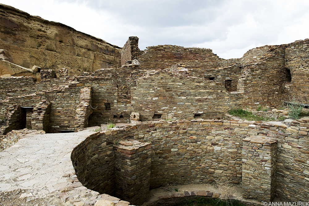
Pueblo Bonito is a stunning set of ancient ruins located at the remote Chaco Culture National Historical Park in New Mexico.
The pavement turned into gravel. My fingers tightened on the steering wheel as the gravel faded into a washboard dirt road. The horizon was empty except for the occasional abandoned house.
My first thought: Am I driving into the beginning of a horror movie?
Earlier that morning, I was at my friend Sean’s apartment in Santa Fe, New Mexico planning my route to Page, Arizona. I was one day into a three-week cross-country road trip. Sean suggested a few places to stop on the way including Chaco Canyon, a national park known for pueblo ruins from the 9th century. Since there’s nothing I love to photograph more than ruins (except for ruins with alpacas!), I jumped at the chance. It was only a 21- mile detour off the main road.
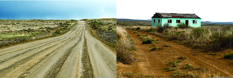
Left: The northern entrance to the park is on Highway 7950 is a rough dirt road. Right: Abandoned houses line the road.
Now, I was regretting that decision as I bounced along the dirt road feeling like I was the backseat of a jeep in rural India. Every two minutes, I considered turning around. I was driving 10 mph, and my car was shaking so violently that I thought it might fall apart at any second.
A black dot appeared on the horizon like a desert mirage and bounced closer into view. It was a black Ford Mustang struggling to get down the road. If a Mustang could drive this road, then so could Betty! (Betty is my Kia Spectra and faithful travel companion.) Then, a small RV appeared on the horizon strategically maneuvering all the ruts in the road. I was clearly in the right place!
The park entrance FINALLY came into view. It was a beautifully PAVED road! I literally screamed “Hallelujah!” out loud. The park itself included a nine-mile paved loop linking the main ruins and several hiking trails to other sites.
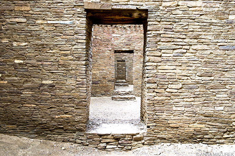
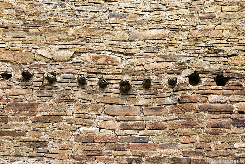
Doorways inside the Pueblo Bonito. Many of the buildings and walls were built for astrological purposes and align with solstices.
My first stop was the most important and stunning set of ruins in the park – Pueblo Bonito. The structure once had four floors and over 660 rooms. The view was surreal and worth every minute of the terrible drive. I instantly felt like I was back at Machu Picchu walking through elaborately built Inca ruins. Both the Chacoans and the Incas were master builders.
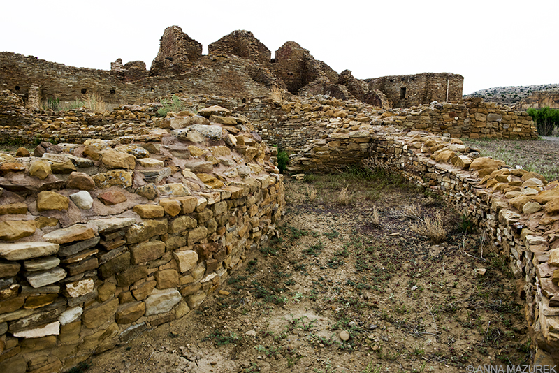
The smaller Pueblo del Arroyo structure was built in two stages between AD 1025 to AD 1125.
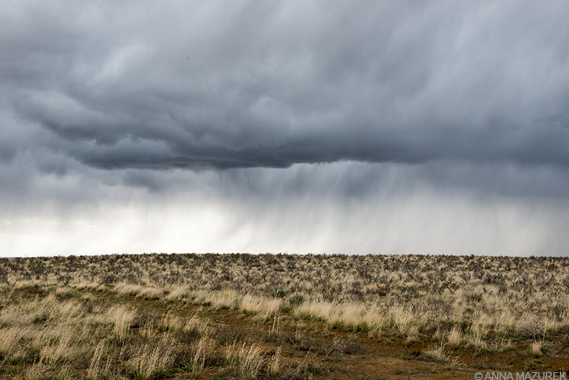
A storm started moving in as I was heading to the next set of ruins, Pueblo del Arroyo. The lightning and thunder were intense, but it did not seem to be moving in my direction. I put on my raincoat and used my rain cover for my bag to cover my camera.
My last stop was Casa Rinconada, the largest excavated kiva in the park. (Kivas are partially underground structures used by Puebloans for religious ceremonies.) It was impressive but nothing is as stunning as Pueblo Bonito.
The thunder and lightning appeared to heading off to the North, which was a relief for my photos. It was nearing the deadline I had set to leave the park (3:30 p.m.) in order to make it to my campground reservation in Page, Arizona before they closed at 9 p.m. (It’s a five-hour drive, but the time zone change gave me an extra hour.)
Keep an eye on the weather during any visit to Chaco Canyon. Both entrance roads are dirt and can become very rough.
Then, I realized the storm was headed straight for the nightmarish dirt road, the only northern exit from the park. (There are only two exits, and apparently, that horrible road I took is the best.) I suddenly remembered the dry riverbed I drove across on the way to the park, and the giant signs that read “Do not cross if ANY water is present.” I panicked and headed for the exit.
Once the pavement ended, I was bouncing along through the horror movie set again on the dirt road behind another car. More cars appeared in my rearview mirror trying to beat the storm. I smiled. We were in this adventure together.
The storm loomed in the distance and paralleled the dirt road the entire drive back to the main (nicely paved) highway like a vulture stalking its prey. When I reached the riverbed, it was dry. Even the paved roads were still a bit rough, but I made it to Page, Arizona with 20 minutes to spare.
When I posted a Chaco Canyon photo on Instagram, I laughed at a friend’s comment: “We wanted to go there but ran out of time and worried about getting through the dirt roads!”
Sometimes, the most amazing places are the hardest to reach.
The wooden beams used in the houses came from the Zuni Mountains (50 miles south) and Chuska Mountains (50 miles west).
Tips for Visiting Chaco Canyon
Fees/Camping: $16 per vehicle for 7-day pass; camping is $15 per site and must be reserved in advance.
How to get there: There are two roads to Chaco Culture National Historical Park. (See map here.) From the north coming from I-25: Follow highway 550 past Cuba then turn left just past a convenience store (mile 112.5) onto CR7900. There’s a sign but it’s small. This road ends shortly at a stop sign. Turn right on, CR7950, which deteriorates quickly to a gravel road and eventually leads you to the park, which has glorious paved roads! It’s 20.5 miles from the turn off to the park but it’ll take you a good hour possibly depending on road conditions. From the south of the park: From I-40, take highway 371from Thoreau to highway 9 before turning on CR57. (Highway 371 will take you to Bisti Wilderness as well. You can also get off I-40 at Milan then take highway 605 to 509 to 9.
The road to the north of the park is shorter and more frequently traveled. Both roads can be a mess after rain. Check the weather, and call the visitors center (505-786-7014) for route recommendations before your trip. Cell signal is minimal – do NOT rely on GPS!
Best time to visit: Avoid the winter due to snow and ice. Roads can be messy in the rainy season (July – Sept.). The weather is best in the spring and fall (Sept. – Oct.).
Why are the roads to Chaco Canyon so bad?
According to the visitor’s center, the roads crisscross both county and tribal land. Each party is responsible for the maintenance of their section. There is also industrial traffic from oil fields in the area. Google theorizes that the poor road conditions keep out large-volume tour bus traffic and helps preserve the park, which only has minimal facilities. Learn from my misadventures: If you’re traveling in the Southwestern U.S., be sure to research all road conditions! Some of the roads in the area (including the CR7500 near Bisti Wilderness area) are improving due to the oil companies working in the area.
For more location guides, sign up for my email list below!